
SuperDARN Workshop 2026 in Nagoya, Japan, June 7-12 - Website is up
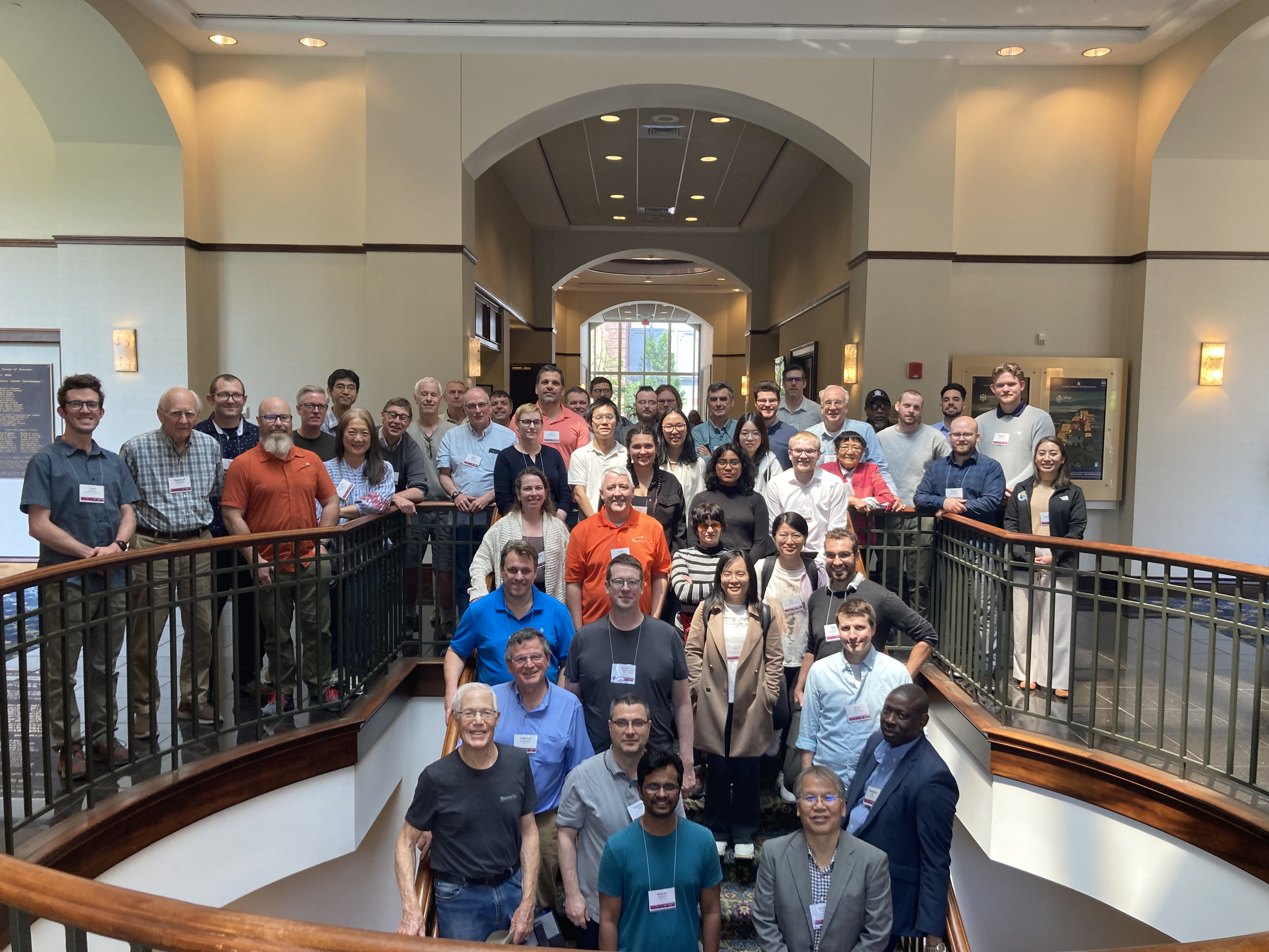
Presentations from the 2025 SuperDARN Workshop now posted
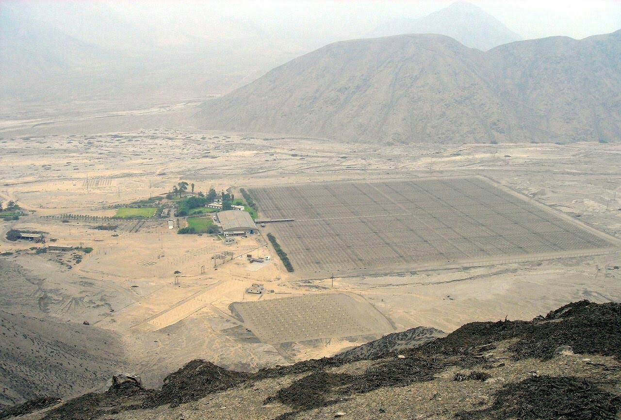
2026 Research Opportunity at the Jicamarca Radio Observatory in Peru - Applications due Feb. 22
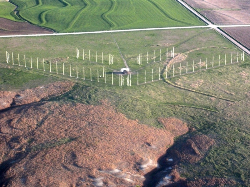
Aerial view of the Fort Hays SuperDARN site operated by Virginia Tech.
Mid-latitude SuperDARN review.
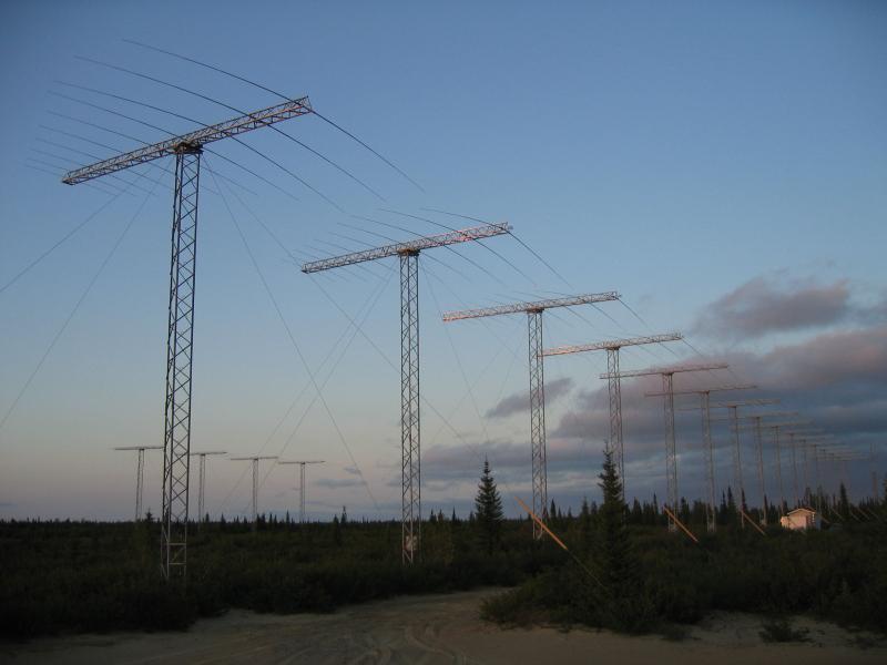
Goose Bay Radar: The grand old dame of HF radars.
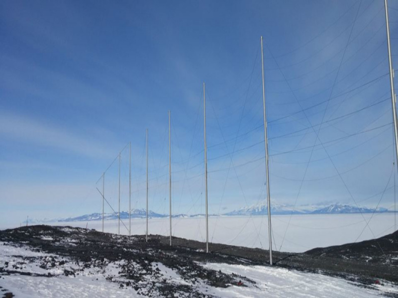
SuperDARN radar at the McMurdo station in Antarctica.
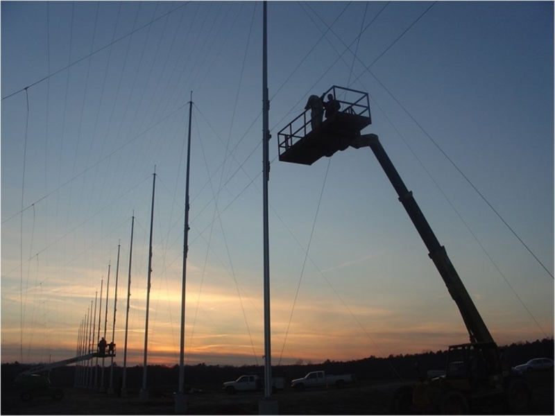
View of the Blackstone SuperDARN radar operated by Virginia Tech.
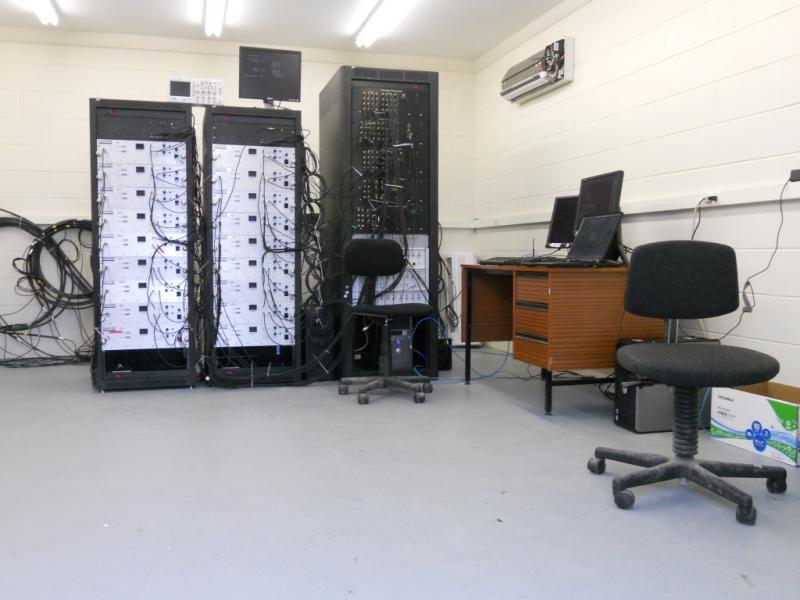
Electronics at the Blackstone radar site.
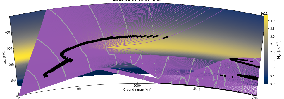
An example of a ray tracing simulation.
Latest News
SuperDARN
View AllSuperDARN Workshop 2026 in Nagoya, Japan, June 7-12 - Website is up
The SuperDARN Workshop 2026 will be held in Nagoya, Japan, at the Higashiyama campus of Nagoya Un...
Presentations from the 2025 SuperDARN Workshop now posted
On behalf of the Organzing Committee Kevin Sterne has announced that presentations from the 2026...
Radar Software Toolkit v5.1.1 released
On behalf of the Data Analysis working Group (DAWG) Kevin Sterne has announed a new release of th...
Virginia Tech
View AllVT SuperDARN undergraduate interns present at the Summer Research Symposium
Four SuperDARN undegraduate interns presented posters at the 2025 edition of the Virginia Te...
Student Opportunities (Current postings: 2)
View All2026 Incoherent Scatter Radar (ISR) Summer School - Applications due March 19
From the announcement to the CEDAR newsletter: Applications are now open for the 2...
About SuperDARN
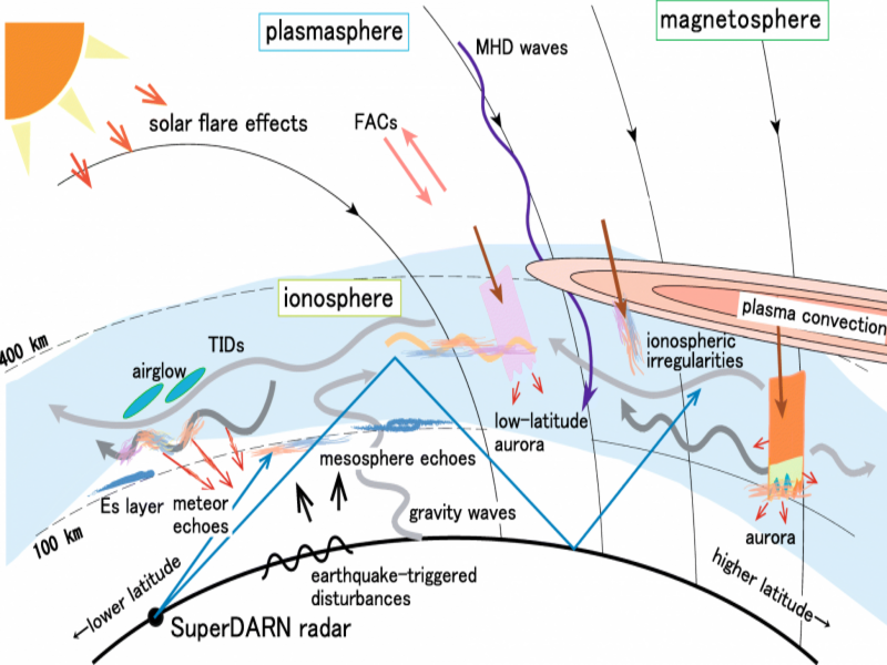
SuperDARN stands for Super Dual Auroral Radar Network. The network consists of more than 30 low-power HF radars that look into Earth's upper atmosphere beginning at mid-latitudes and extending into the polar regions. The radars operate continuously and observe the ionosphere and other effects that provide scientists with information about Earth's space environment. The knowledge gained from this work provides insight into space weather hazards including radiation exposure for high-altitude travelers and disruptions to communication networks, navigation systems (GPS), and electrical power grids.
How to Acknowledge use of SuperDARN data
The research enabled by SuperDARN is due to the efforts of teams of scientists and engineers working in many countries to build and operate radars, process data and provide access, develop and improve data products, and assist users in interpretation.
Users of SuperDARN data and data products are asked to acknowledge this support in presentations and publications. A tool to generate suitable text is available here.
The tool will also generate a Table of persons to contact regarding the use of data from particular radars. In addition, a complete listing of radars and PIs with their contact information can be found here.
U.S. SuperDARN Collaboration
The U.S. component of SuperDARN is funded by the National Science Foundation under the Space Weather Research (SWR) Program as a collaboration between Virginia Tech (lead institution), Dartmouth College, Penn State University, and the Johns Hopkins University Applied Physics Laboratory (JHU/APL).
Click logos for access to the web sites of the U.S. partners:


International SuperDARN Collaborators
In addition to the U.S. partners, the SuperDARN collaboration counts many international partner institutions that share an interest in studies of the ionosphere and the relationship between the ionosphere and space weather.